
News Summary
A dangerous outbreak of severe thunderstorms is forecasted to impact parts of the Midwest, South, and East from Friday through the weekend. The NOAA has issued a level 4 out of 5 risk for severe weather, highlighting the potential for damaging winds, tornadoes, and heavy rainfall leading to flooding. Key areas include St. Louis, Memphis, and parts of Alabama and Mississippi. Residents are advised to prepare for the severe weather and have a safety plan in place.
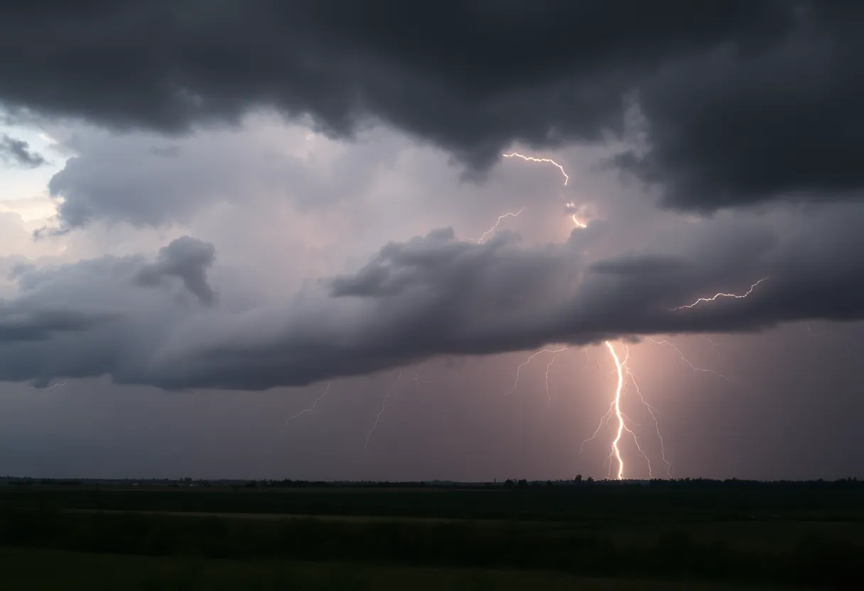
Heads Up: Severe Thunderstorm Outbreak on the Way!
Are you ready? A *dangerous outbreak of severe thunderstorms* is set to hit parts of the Midwest, South, and East starting this Friday and continuing through the weekend. The National Oceanic and Atmospheric Administration’s (NOAA) Storm Prediction Center has raised the alarm by issuing a *level 4 out of 5 risk* for severe weather on both Friday and Saturday in select areas. This rare risk level is not something you see every day, typically popping up only about 11 to 12 times each year, which signals the potential for some *serious storm activity*.
What To Expect
So, what does this all mean for you? The thunderstorms are expected to develop from *supercells*—powerful storms that can create strong tornadoes—or from long-lived squall lines that can bring *damaging winds*. These storms arrived late Friday afternoon and will push eastward, moving through the night. Residents in the impacted areas, especially **St. Louis**, **Paducah** (Kentucky), **Memphis** (Tennessee), and **Jackson** (Mississippi), should be vigilant and have a plan in place for safe shelter.
Where Are The Risks?
The *Midwest and South* are bracing for severe weather, with significant threats looming over the *mid-Mississippi Valley*. Specifically, the greatest impacts are forecasted for **St. Louis**, where folks need to stay close to their storm shelters from late afternoon through late Friday night. Severe storms will likely kick off late in the afternoon on Friday, so be prepared!
Watch Out For These Threats
When it comes to what to expect, listen up! We’re talking about the potential for *damaging wind gusts between 70 to 90 mph*, *tornadoes* that could reach EF2 strength or stronger, and large hail. The most concerning areas in the Deep South include **Alabama**, **Georgia**, **Louisiana**, **Mississippi**, **Tennessee**, and even parts of the *western Florida Panhandle*. Cities like **Atlanta**, **Birmingham**, **Huntsville**, **Montgomery**, and **Chattanooga** are in the crosshairs too. The risk extends from southeastern Louisiana to central and southern Mississippi, affecting much of Alabama.
Flooding Concerns
Heavy rain could also trigger flash flooding in parts of northern *Alabama*, *Mississippi*, *Georgia*, *Tennessee*, and *Kentucky*. As we move into the weekend, another cold front could generate even more storms all the way from the mid-Atlantic states down to the Southeast, potentially impacting *Charleston* (South Carolina), *Raleigh* (North Carolina), *Philadelphia*, and *Washington D.C*.
What About Sunday?
Don’t let your guard down just yet! Some of the storms might linger into the morning on Sunday across parts of the *East*. Severe weather risks will still be on the table, including *damaging wind gusts*, isolated tornadoes, and the chance of localized *flash flooding*.
Keep Your Eye on The Sky!
With over *100 million people* from at least 30 states at risk during this multi-day weather event, it’s time to stay informed. On Friday alone, roughly *70 million people* will likely face severe weather. The tornado threat stretches over 1,000 miles, reaching all the way from *Iowa* to *Mississippi*, putting more than *6.5 million people* in high-threat zones, including folks in *Missouri*, *Iowa*, *Illinois*, *Kentucky*, *Tennessee*, and *Arkansas*.
Be sure to have multiple ways to receive warnings, especially since these storms could come at all hours, including the night. Stay safe and look out for each other during this upcoming weather outbreak!
Deeper Dive: News & Info About This Topic
- The Weather Channel: Severe Storm Outbreak
- Google Search: Severe Weather
- Fox Weather: Weekend Outbreak
- Wikipedia: Tornado
- Agriculture.com: Severe Thunderstorms
- Encyclopedia Britannica: Storm
- ABC News: Tornadoes and Flooding
- Google News: Severe Thunderstorm Outbreak
- AOL: Severe Thunderstorm Outbreak
- Google Scholar: Tornado Forecast
- The New York Times: Storms and Tornado Forecast

Author: STAFF HERE TALLAHASSEE WRITER
The TALLAHASSEE STAFF WRITER represents the experienced team at HERETallahassee.com, your go-to source for actionable local news and information in Tallahassee, Leon County, and beyond. Specializing in "news you can use," we cover essential topics like product reviews for personal and business needs, local business directories, politics, real estate trends, neighborhood insights, and state news affecting the area—with deep expertise drawn from years of dedicated reporting and strong community input, including local press releases and business updates. We deliver top reporting on high-value events such as Springtime Tallahassee, Tallahassee Jazz & Blues Festival, and LeMoyne Chain of Parks Art Festival. Our coverage extends to key organizations like the Greater Tallahassee Chamber of Commerce and United Way of the Big Bend, plus leading businesses in education, healthcare, and insurance that power the local economy such as Florida State University, Tallahassee Memorial HealthCare, and Capital Health Plan. As part of the broader HERE network, including HEREJacksonville.com, HEREOrlando.com, HEREStPetersburg.com, and HERETampa.com, we provide comprehensive, credible insights into Florida's dynamic landscape.