
News Summary
Tallahassee is expected to experience scattered showers and storms as Tropical Wave 91L approaches. While residents should prepare for wet weather on Monday, drier air is forecasted later in the week, with temperatures warming up. The National Hurricane Center is also monitoring Tropical Storm Erin. Residents are encouraged to stay updated on local weather alerts and conditions as unpredictable storms are a possibility.
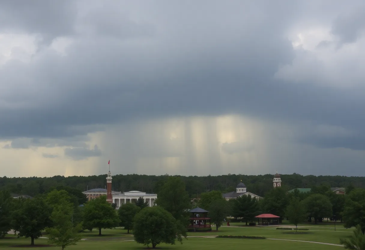
Tallahassee is bracing for scattered showers and storms on Monday afternoon, accompanied by a tropical wave located 1,500 miles east of the Lesser Antilles, designated as 91L. Residents are advised to keep rain jackets handy as the system could bring unexpected weather. This wave is currently gaining organization and may develop into a tropical depression by Friday or Saturday.
A cold front is expected to pass through the area, bringing with it drier air afterward. Though scattered storms are anticipated on Monday, the prospects for rain will diminish throughout the week. By Thursday, sunny conditions are forecasted, with temperatures climbing to the upper 80s during the day and dipping into the upper 60s at night. This could signal a brief taste of fall for residents of Tallahassee.
The tropical wave designated 91L is being closely monitored, as it is projected to move generally westward, potentially threatening the Lesser Antilles and Puerto Rico. If the system continues on its current path, meteorologists expect a northward turn as it approaches the eastern Caribbean, but uncertainty remains high regarding its impact on the U.S. East Coast.
According to forecasts, the current hurricane season has seen a below-average number of tropical storms and hurricanes. However, meteorological predictions suggest the latter half of the season may be more active. The emergence of La Niña conditions, which typically leads to lower wind shear, may also contribute to increased storm activity in the coming weeks.
Additionally, the National Hurricane Center is keeping an eye on Tropical Storm Erin, which is expected to approach the northern Leeward Islands over the upcoming weekend. Though it poses no threat to the Northeast Gulf Coast currently, it is being monitored for its potential to strengthen. Forecasters warn of possible life-threatening surf and rip currents near the affected coastal areas.
Localized storms in Tallahassee may continue on Tuesday as the cold front is expected to stall further to the south. Residents are urged to stay updated with local news alerts and weather channels as patterns may shift unpredictably.
This upcoming weather pattern will be most prominent in various areas in and around Tallahassee, impacting key locations such as parks, outdoor venues, and local businesses. People engaging in outdoor activities should be particularly vigilant about weather conditions as scattered storms may emerge unexpectedly.
In summary, while residents face a mix of storms on Monday, an overall decrease in rain chance heading into the week may bring more pleasant weather by Thursday, with highs in the upper 80s and the start of cooler mornings. The monitoring of Tropical Wave 91L and Tropical Storm Erin continues to be of significant importance as the hurricane season approaches its peak.
Deeper Dive: News & Info About This Topic
HERE Resources
Florida Prepares for Potential Tropical Storm Developments
Hurricane Kiko Powers Up to Category 4 as it Heads Towards Hawaii
Events to Enjoy This Weekend in Tallahassee
Hurricane Kiko Intensifies: A Closer Look at the Category 4 Storm
Hurricane Kiko Strengthens to Category 4, Approaching Hawaii
Local Schools Launch Football Season with Thrilling Matchups
Southern Shakespeare Company Receives Generous Donation
Georgia Braces for Extreme Heat This Weekend
Legislation to Repeal HOAs Under Consideration in Florida
Tallahassee City Commission Reviews AI Integration in City Operations
Additional Resources
- Tallahassee.com: September Florida Hurricane Season Forecast
- Wikipedia: Hurricane Season
- Tallahassee.com: Tropical Storm Erin Tracker
- Google Search: Tropical Storm Erin
- Tallahassee.com: July Fourth Weather
- Google Scholar: Hurricane Impact on Florida
- Tallahassee.com: Hurricane Center Monitoring
- Encyclopedia Britannica: Hurricane Forecasting
- Tallahassee.com: Thunder and Hail in Tallahassee
- Google News: Thunder and Hail in Florida

Author: STAFF HERE TALLAHASSEE WRITER
The TALLAHASSEE STAFF WRITER represents the experienced team at HERETallahassee.com, your go-to source for actionable local news and information in Tallahassee, Leon County, and beyond. Specializing in "news you can use," we cover essential topics like product reviews for personal and business needs, local business directories, politics, real estate trends, neighborhood insights, and state news affecting the area—with deep expertise drawn from years of dedicated reporting and strong community input, including local press releases and business updates. We deliver top reporting on high-value events such as Springtime Tallahassee, Tallahassee Jazz & Blues Festival, and LeMoyne Chain of Parks Art Festival. Our coverage extends to key organizations like the Greater Tallahassee Chamber of Commerce and United Way of the Big Bend, plus leading businesses in education, healthcare, and insurance that power the local economy such as Florida State University, Tallahassee Memorial HealthCare, and Capital Health Plan. As part of the broader HERE network, including HEREJacksonville.com, HEREOrlando.com, HEREStPetersburg.com, and HERETampa.com, we provide comprehensive, credible insights into Florida's dynamic landscape.