
News Summary
As Florida approaches the Fourth of July weekend, heightened storm activity is forecasted, with significant rainfall and potential tropical development expected. Rain chances will increase across regions, particularly in Tallahassee and along the Gulf Coast, leading to concerns for flash flooding. Residents are urged to stay informed about weather conditions as a cold front may cause more intense storms and heavy rainfall, impacting holiday plans. The National Weather Service is closely monitoring the situation to provide timely updates.
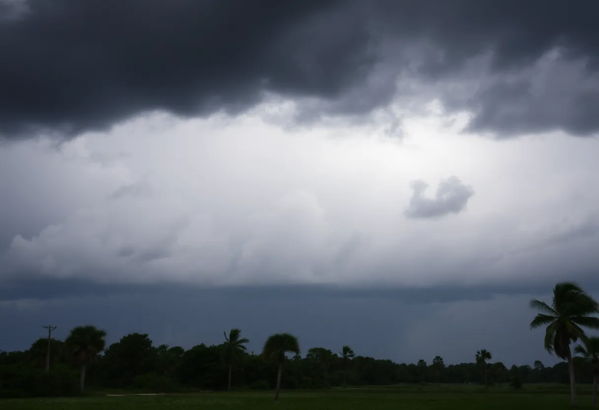
Tallahassee, Florida – Storm activity is set to intensify in Florida ahead of the Fourth of July weekend, with forecasts indicating significant rainfall and potential tropical development. Beginning Sunday afternoon, scattered showers are expected along the I-75 corridor, moving west as a north and easterly wind drives storms from the Atlantic Coast into parts of South Georgia and the Big Bend region.
The heightened storm activity is likely to keep afternoon temperatures cooler on Sunday, but a warm-up is anticipated for the following week as rain chances decrease, with daytime highs approaching the mid-90s. The National Hurricane Center is monitoring low chances (20%) of tropical or subtropical storm formation in the eastern Gulf, as well as along the Florida peninsula and coasts of Georgia and South Carolina.
Forecasters are cautioning residents about a cold front moving into the Southeastern U.S. This system may lead to increased storm activity, potentially resulting in heavier rainfall. Tallahassee is projected to experience a 40-60% chance of rain on Friday, with showers likely subsiding after sunset.
The ongoing cold front is expected to stall near Tallahassee, contributing to thunderstorms and the possibility of heavy rainfall in the Panhandle and southern Georgia. Forecasts predict that Tallahassee could receive 3-4 inches of rain through next Sunday, while coastal areas might see totals of 4-6 inches. This significant accumulation raises concerns for flash flooding in affected areas.
While the Florida Department of Emergency Management has confirmed that this system currently poses no direct threat to the state within the next 5-7 days, it could nonetheless lead to heavy rainfall and gusty winds along the Gulf or Atlantic Coast. Beachgoers are being urged to keep an eye on updates regarding potential rough surf and rip currents as rain chances increase along Florida’s Gulf Coast.
In Tallahassee, rain chances are expected to remain above 85% through Wednesday, with some areas further south along the coast anticipating double-digit rainfall. Heavy rain is likely to contribute to flash flooding at various times, especially on Thursday as the monitored system moves across Florida.
Interestingly, a significant plume of Saharan dust is expected to influence southern U.S. weather patterns, which may result in “dirty rain” for Florida over the Fourth of July weekend. This could impact outdoor plans and overall conditions during the holiday period.
Residents are advised to stay informed about changing weather conditions as the forecast evolves. Appropriate preparations may be necessary to ensure safety and minimize disruption from heavy rain and potential flooding. With the holiday weekend approaching, the potential for storm activity may affect celebrations, prompting residents and visitors to consider alternate plans.
The National Weather Service and local meteorologists will continue to monitor the situation closely, providing updates as new information becomes available. As the state prepares for the Fourth of July, it’s essential for everyone in the region to remain aware of the forecast and prepared for possible adverse weather conditions.
Deeper Dive: News & Info About This Topic
HERE Resources
Farmers’ Almanac Predicts Harsh Winter Ahead
New Chief of Police Appointed at FSU Amid Safety Initiatives
Leon County Schools Closed Due to Icy Conditions
Florida Faces Increased Hurricane Risk Amid Marine Heat Wave
Leon County Launches Next-Generation 911 System
Tallahassee Prepares for Severe Weather and Tornadoes
Severe Weather Alerts and Flood Watches Affect Florida
Tallahassee Braces for Severe Weather and Heavy Rain
Spectacular Pileus Clouds Grace Central Florida Skies
Severe Thunderstorm Alert Issued for Lake County, Illinois
Additional Resources
- Tallahassee.com: Tropical Storm Rain on July Fourth
- Tallahassee.com: North Florida Severe Weather Forecast
- ABC7: Hurricane Helene Threatens Unsurvivable Storm Surge
- WPTV: Hurricane Helene Threatens Unsurvivable Storm Surge
- Wikipedia: Hurricanes in the United States
- Encyclopedia Britannica: Hurricane

Author: STAFF HERE TALLAHASSEE WRITER
The TALLAHASSEE STAFF WRITER represents the experienced team at HERETallahassee.com, your go-to source for actionable local news and information in Tallahassee, Leon County, and beyond. Specializing in "news you can use," we cover essential topics like product reviews for personal and business needs, local business directories, politics, real estate trends, neighborhood insights, and state news affecting the area—with deep expertise drawn from years of dedicated reporting and strong community input, including local press releases and business updates. We deliver top reporting on high-value events such as Springtime Tallahassee, Tallahassee Jazz & Blues Festival, and LeMoyne Chain of Parks Art Festival. Our coverage extends to key organizations like the Greater Tallahassee Chamber of Commerce and United Way of the Big Bend, plus leading businesses in education, healthcare, and insurance that power the local economy such as Florida State University, Tallahassee Memorial HealthCare, and Capital Health Plan. As part of the broader HERE network, including HEREJacksonville.com, HEREOrlando.com, HEREStPetersburg.com, and HERETampa.com, we provide comprehensive, credible insights into Florida's dynamic landscape.