
News Summary
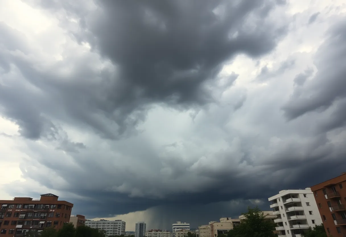
Tallahassee is bracing for a weekend of severe weather, including potential tornadoes and heavy rainfall. The National Weather Service has issued warnings for several counties, with rainfall totals expected to reach 3-6 inches. Residents are urged to stay alert for severe weather and consider safety measures, especially in mobile homes. Public updates will continue as conditions evolve over the weekend.
Tallahassee Braces for Severe Weather as Potential Tornadoes and Heavy Rainfall Loom
Tallahassee, FL is preparing for a weekend of severe weather, with the National Weather Service warning of possible tornadoes and heavy rainfall across north Florida and the Panhandle. Temperatures are expected to remain in the high 80s, with heavy downpours forecast for both Saturday and Sunday.
The imminent weather system is being monitored by the National Hurricane Center, which notes the potential for a tropical or subtropical storm system developing in the eastern Gulf. As of June 30, the chances of this development are relatively low at 20%. However, meteorologists predict that rain chances will rise significantly over the weekend, especially along the Gulf Coast, where areas may experience flash flooding due to previously saturated soils.
Rainfall totals for Tallahassee are estimated to be around 3-4 inches through the weekend, while coastal areas could see higher totals of 4-6 inches. The front responsible for this heavy rain is expected to weaken off the southeast U.S. coast, but an area of low pressure could form as early as Saturday, leading to increased risks for severe weather.
Severe Weather Warnings and Risks
The National Weather Service has issued tornado watches for several counties in northern Florida, including Leon County. These watches are expected to remain in effect until 10 a.m. Sunday. Meteorologists warn residents to stay alert for long-track tornadoes, potentially reaching EF2 intensity, along with damaging winds exceeding 70 mph and large hail. The most severe impacts are anticipated from late Saturday into early Sunday morning.
In addition to rainfall, thunderstorms are expected across the region due to a stalled frontal boundary. Rain chances on Friday are anticipated to range from 40-60%, tapering off post-sunset. By Saturday, rainfall in the Panhandle could reach 1-2 inches, with isolated areas experiencing totals of 2-4 inches.
Public Safety Concerns
As heavy rains and strong winds loom, the Florida Department of Emergency Management emphasizes the need for public vigilance. While there are currently no direct threats expected for the next 5-7 days, the potential for locally heavy rainfall and gusty winds may impact coastal areas. The increased likelihood of flash flooding could also affect tree stability and utility lines.
The Tallahassee NOAA Weather Radio emergency broadcast system was reported out of service during critical weather times, highlighting the importance of having multiple alert systems available for residents. As conditions continue to evolve, updates from the National Weather Service will keep the public informed about impending weather developments.
Looking Ahead
Rain chances are expected to exceed 85% through July 2, with the heaviest rain predicted to hit on July 3. In light of these conditions, a public safety alert has been issued, especially for residents living in mobile homes, advising them to seek shelter in more robust facilities.
With the significant potential for a major severe weather event predicted across a wide swath of the U.S., residents of Tallahassee and the surrounding areas are urged to stay attuned to weather updates and prepare for possible disruptions caused by inclement weather this weekend.
Deeper Dive: News & Info About This Topic
HERE Resources
Severe Weather Alerts and Flood Watches Affect Florida
Tallahassee Braces for Severe Weather and Heavy Rain
Florida Schools Regain Control Over Start Times
Severe Thunderstorm Alert Issued for Lake County, Illinois
Rainey Cawthon Distributors Expands Fuel Storage Capacity
August Brings Relief After a Heat-Heavy July
Tragedy Strikes Ruidoso as Flash Flooding Claims Lives
Leon County Unemployment Rate Increases
Devastation from the Dragon Bravo Fire at Grand Canyon’s North Rim
Central Florida Faces Extreme Heat and Weather Alerts
Additional Resources
- Tallahassee.com: Tropical Storm on July Fourth
- Wikipedia: Tropical Storm
- PNJ: Weekend Forecast – Tornadoes and Rain
- Google Search: Florida Weather Forecast
- WTXL: Weather Service Review
- Google Scholar: Tornadoes in Florida
- Tallahassee.com: Weather Forecast – Tornadoes and Hail
- Encyclopedia Britannica: Weather Forecasts
- Tallahassee.com: Weather Radar – Severe Storms
- Google News: Severe Weather Florida

Author: STAFF HERE TALLAHASSEE WRITER
The TALLAHASSEE STAFF WRITER represents the experienced team at HERETallahassee.com, your go-to source for actionable local news and information in Tallahassee, Leon County, and beyond. Specializing in "news you can use," we cover essential topics like product reviews for personal and business needs, local business directories, politics, real estate trends, neighborhood insights, and state news affecting the area—with deep expertise drawn from years of dedicated reporting and strong community input, including local press releases and business updates. We deliver top reporting on high-value events such as Springtime Tallahassee, Tallahassee Jazz & Blues Festival, and LeMoyne Chain of Parks Art Festival. Our coverage extends to key organizations like the Greater Tallahassee Chamber of Commerce and United Way of the Big Bend, plus leading businesses in education, healthcare, and insurance that power the local economy such as Florida State University, Tallahassee Memorial HealthCare, and Capital Health Plan. As part of the broader HERE network, including HEREJacksonville.com, HEREOrlando.com, HEREStPetersburg.com, and HERETampa.com, we provide comprehensive, credible insights into Florida's dynamic landscape.